 |
 |
 |
 |
 |
 |
 |
 |
 |

|
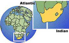
South Africa occupies the southernmost part of the African continent, stretching from 22 to 35° S latitude and from 17° to 33° E longitude. Its surface area is 1 219090 square kilometres and it shares common boundaries with the republics of Namibia, Botswana and Zimbabwe. The Republic of Mozambique and the Kingdom of Swaziland lie to the northeast while in the southeast, the mountain kingdom of Lesotho lies completely enclosed by South African territory. To the west, south and east, South Africa borders on the Atlantic and Indian oceans. Isolated in the Atlantic some 1 920 km southeast of Cape Town lie Prince Edward and Marion islands.
Current flows northwards along the west coast as far as southern Angola. The contrast in temperature between these two currents partly accounts for important differences in climate and vegetation between the east and west coasts of South Africa. The contrast also contributes to the big differences in marine life. The South African fishing industry is centred on the west coast, where the cold waters are much richer in oxygen, nitrates, phosphates and plankton than those of the east coast. The South African coastline is even, punctuated by few natural harbours. The only ideal natural harbour along the coastline is Saldanha Bay on the west coast. However, the area lacks fresh water and offers no natural lines of penetration to the interior. Most river mouths are unsuitable for use as harbours since large sand bars block entry for a large part of the year. These bars are formed by the action of waves and currents, and by the intermittent flow, heavy sediment load and steep gradients of most South African rivers. Only the largest rivers, such as the Orange and Limpopo, maintain narrow permanent channels through the bars. For much the same reasons, the country has no navigable rivers.
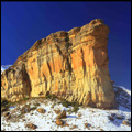
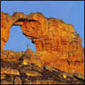
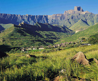
The surface area of South Africa falls into two major physiographic features: the interior plateau and the land between the plateau and the coast. Forming the boundary between these two areas is the Great Escarpment, the most prominent and continuous relief feature of the country. Its height above sea level varies from approximately I 500 m in the dolerite-capped Roggeveld in the southwest to a height of3 482 m in the KwaZulu-Natal Drakensberg. Inland from the Escarpment lays the interior plateau, which is the southern continuation of the great African plateau stretching north to the Sahara Desert. The plateau itself is characterised by wide plains with an average height of I 200 m above sea level. Surmounting the plateau in places is a number of well-defined upland blocks. The dissected Lesotho plateau, which is more than 3 000 m above sea level, is the most prominent. In general, the Escarpment forms the highest parts of the plateau. Between the Great Escarpment and the coast lies an area which varies in width from 80 to 240 km in the east and south to a mere 60 to 80 km in the west. At least three major subdivisions can be recognised: the eastern plateau slopes, the Cape folded belt and adjacent regions, and the western plateau slopes. |